
Trace a Colleyville Street Directory
A street-level search in Colleyville works best as a record chain, not as a list of people. Begin with the property address in the Tarrant Appraisal District, then use the account or georeference to inspect the parcel in the county map. Record the owner label exactly as displayed, including a trust or organization name. Next, search the legal description and the parties in the deed index. Registration information belongs in a separate, regulated election context. Historic directories and census material can provide dated context, but neither replaces the county land record.
- Search the address in the Tarrant Appraisal District and preserve the account number, georeference, property city, and legal description.
- Enter the address or account in the Tarrant County GIS Public Map Viewer. Check the parcel shape and available layers before opening nearby records.
- Read the primary-owner field as an appraisal label. Compare the property address with any displayed mailing address instead of assuming they are the same.
- Use Tarrant County Public Search for grantor, grantee, subdivision, document type, date, and legal-description searches. Confirm the instrument image before relying on an index hit.
- Use voter tools only for lawful registration and precinct research. For an older address, request verified directory or archive material rather than assuming a reverse directory exists.
The chain separates land records from person records. It also leaves room for a road name that changed, a subdivision label that differs from a familiar neighborhood name, or a parcel whose mailing address is outside Colleyville.
Colleyville Street Parcel Search
The Tarrant Appraisal District property search offers Residential, Commercial, Mineral, and Personal Property choices with a free-text query. Its results show the account number, georeference, property address, property city, primary owner name, and market value. The detail record can add a legal description, subdivision, Mapsco reference, jurisdiction row, map links, and owner-address display. Those fields tie an address to a parcel record. They do not establish that the named owner occupies the property, and an appraisal value is not a sale price.
| TAD field | How it appears | Careful use |
|---|---|---|
| Property type | Residential, Commercial, Mineral, or Personal Property | Sets the query category. |
| Free-text query | Address, owner, account, or georeference lead | Start with the complete address, then compare variants. |
| Account and georeference | Displayed result fields | Useful parcel keys for map and tax follow-up. |
| Property address and city | Situs display | Keep separate from the owner mailing address. |
| Primary owner and market value | Displayed result fields | Owner label and appraisal figure, not occupancy or sale proof. |
For a Colleyville street directory search, copy the legal description and subdivision after locating the street address. A block and lot or georeference can still find a parcel when a street spelling, replat, or older road reference produces weak results.
Colleyville Street Map Context
The Tarrant County GIS Public Map Viewer accepts address, account, and owner searches and offers map layers and facilities. It is the map companion to the TAD record. Search the target first, zoom to its boundary, then inspect the visible road, creek, and parcel context. The observed viewer did not document a radius, buffer, export, or dedicated adjacent-parcel command. Nearby parcels therefore need individual review rather than a claimed automatic neighborhood search.
| GIS input or control | What it supports |
|---|---|
| Address | Locates the mapped address for a parcel check. |
| Account | Connects the map inquiry to a county or appraisal account. |
| Owner | Offers an owner-name route that needs parcel-by-parcel confirmation. |
| Layer List and Facilities | Adds county and city map context, not a proof of residence. |
Note: A map shape can clarify parcel context, but the official research did not document an automatic adjacent-parcel or radius tool.
Colleyville Street Record Sets
Different custodians answer different address questions. TAD supplies the appraisal account and owner display. The Tarrant County Tax Office supports account, owner-address, and payment context. GIS supplies the map geometry. The clerk index points to recorded instruments. City files can explain a plat or building action. Treat every field as the role the custodian assigns to it, not as a substitute for a current household roster.
| Address record | Custodian | What it can show | Key limit |
|---|---|---|---|
| Appraisal parcel | Tarrant Appraisal District | Account, legal description, owner label, value | Owner display is not occupancy proof. |
| Tax account | Tarrant County Tax Office | Account and owner-address or payment context | Mailing and property addresses can differ. |
| Parcel map | Tarrant County GIS | Address, account, owner route, layers | No documented radius search. |
| Recorded instruments | Tarrant County Clerk | Deeds, plats, releases, and related index leads | The clerk does not perform a title or lien search. |
| City land files | Colleyville Community Development | Plats, permits, and planning context | Permit page fields were not captured. |
A parcel number may connect the first three sets. The legal description bridges an address to recorded land documents. A street name alone can miss a document filed under a subdivision, Block and Lot, or older alignment.
Colleyville Street Deed Trail
Tarrant County Public Search is an instrument index, not a conclusion about a person or property. Quick Search supports grantor or grantee, subdivision, document type, document number, and recorded-date searches. Advanced Search adds department, party, grantor, grantee, document-number ranges, book-volume-page, OCR phrase, and legal-description choices. Run a street search as a lead, then repeat it with the subdivision or legal description. A deed may omit the modern street label entirely.
The Tarrant County advanced search shows the party, department, document, book-volume-page, OCR, and legal-description paths available for narrowing an instrument query.
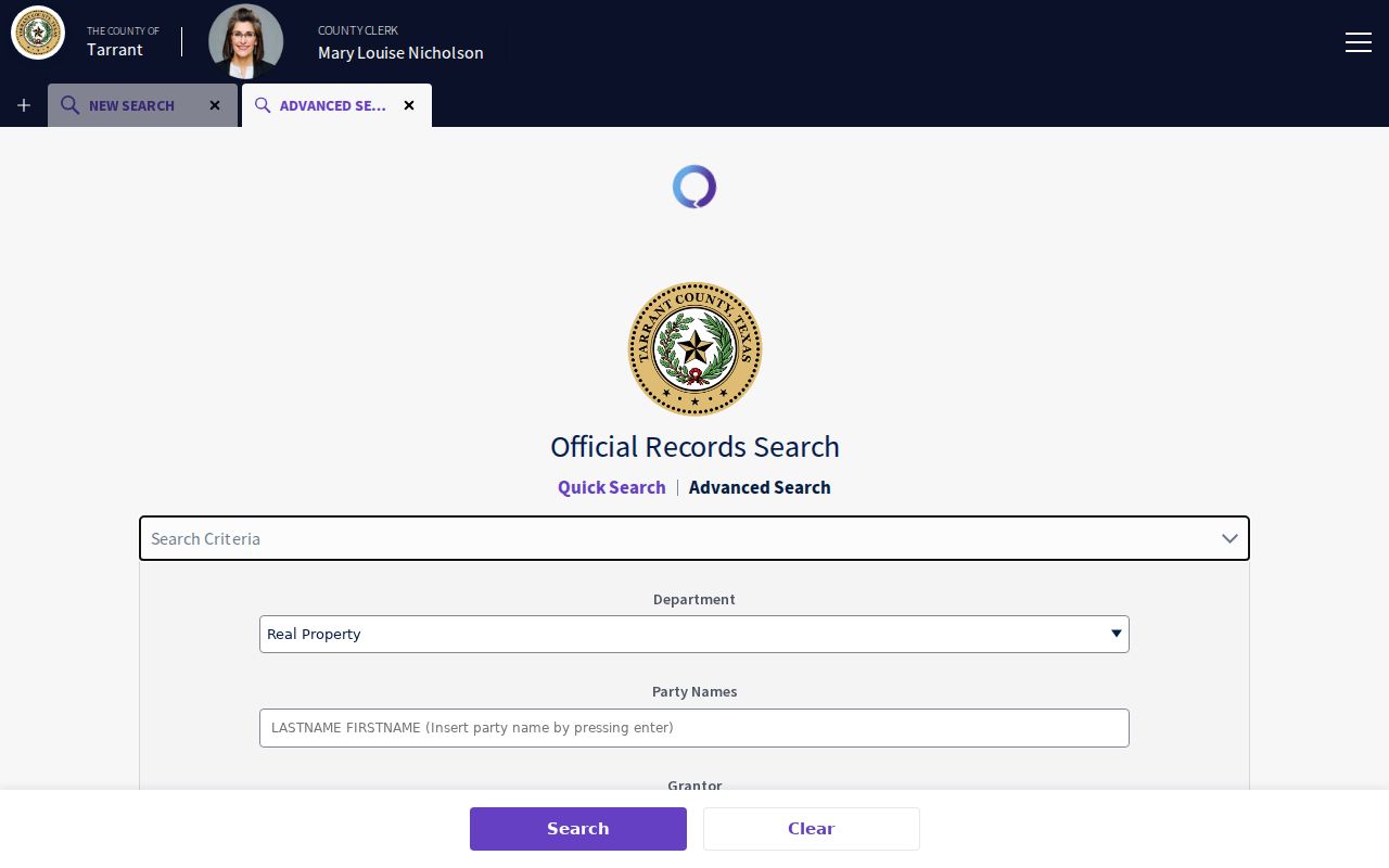
Use the form to preserve the exact query, spelling, date range, document type, and OCR setting in a research note. Then compare the index result with the image or an ordered copy before describing a transfer.
Search parties separately in a chain of title. A grantor transfers an interest; a grantee receives one. Later releases, corrections, deeds of trust, or later conveyances can change the meaning of the newest apparent result.
Colleyville Street Plats and Permits
For an address that does not line up neatly with a map, a plat can settle the land question. Colleyville Community Development says plats can show lots, building lines, easements, rights-of-way, flood markers, and boundary markers. The office is at 100 Main Street and lists 817-503-1050. Use a plat alongside the TAD legal description and the clerk index, especially where a subdivision has phases, replats, or a familiar neighborhood name that differs from the recorded label.
- Parcel
- A mapped unit of land tied to a tax or appraisal account. One parcel can have a street address and a separate legal description.
- Situs address
- The property location used to identify the parcel. It is different from a mailing address used for correspondence.
- Plat
- A recorded land map showing the lot layout and certain recorded lines or easements.
- Criss-cross directory
- A reverse-address style directory that can connect an address to a published listing. No verified Colleyville run was located.
The City of Colleyville permits page lists category and year links for Accessory Buildings, Commercial, Pools, New Single-Family Residences, Residential Additions or Alterations, Demolitions, and Re-roof work from 2022 through 2026. No search-field schema was verified. A permit reflects a municipal project record, not a finding about every person connected with an address.
Colleyville Street History Clues
Older Colleyville address work needs more than the current street name. Before incorporation in 1956, local records may use Spring Garden, Bransford, Pleasant Run, Pleasant Glade, a rural route, or Tarrant County rather than the current city label. Those names are useful search variants for old maps, census material, directories, plats, and deed records. They are not interchangeable addresses, so keep the source date and wording with each result.
A documented continuity problem involves the Bransford Road and Shelton Drive realignment from 1997 through 1999. An older permit, archive note, or directory reference may describe the earlier road arrangement while GIS displays the later one. Compare road names, map dates, subdivision terms, and legal descriptions before declaring that an older address is absent. No official citywide renumbering chronology was located.
Colleyville's six planning areas use HOA service areas, major roads, railroads, and creeks. Legal subdivision names can differ from those planning labels. The difference explains why a local neighborhood description may not appear in the TAD subdivision field or a recorded plat.
A useful record note keeps the old and current terms side by side. List the source date, street or community wording, TAD account if one is found, subdivision, Block and Lot, and the map or document consulted. That small comparison can reveal that two sources describe the same tract in different language. It also shows where the evidence stops. An unverified road match should remain a question for the next primary source, not a forced connection.
Colleyville Street Directory Sources
Historical directories add a dated publication layer to a street search. The verified digital regional material includes 1985 and 1986 Greater Dallas White Pages pages with Colleyville business and civic entries, but no residential reverse-address run was confirmed. Ask the Colleyville Library or Tarrant County Archives for a specific title, year, call number, and access restriction before relying on a directory as an address source.
A name and address in a directory shows that the publisher printed the entry at that time. It does not establish legal ownership or present residence. For a historical address trail, the Colleyville city directory collections provide the separate shelf-and-source context, while TAD and the clerk index remain the modern address anchors.
Colleyville Street Request Routes
Use the clerk's online index first when an instrument is known. The Tarrant County Clerk also documents an online account route, in-person research and copying through Room B30, and a mail request with the document number, a self-addressed stamped envelope, and a cashier's check or money order. In-person or mailed copies are listed at $1 per page plus $5 for certification. The county says ordinary online viewing is generally available 5-7 business days after intake. Fees can change, so verify current costs before ordering.
The Tarrant County real-estate records office identifies the records-intake and fee context for instruments that later reach Public Search.
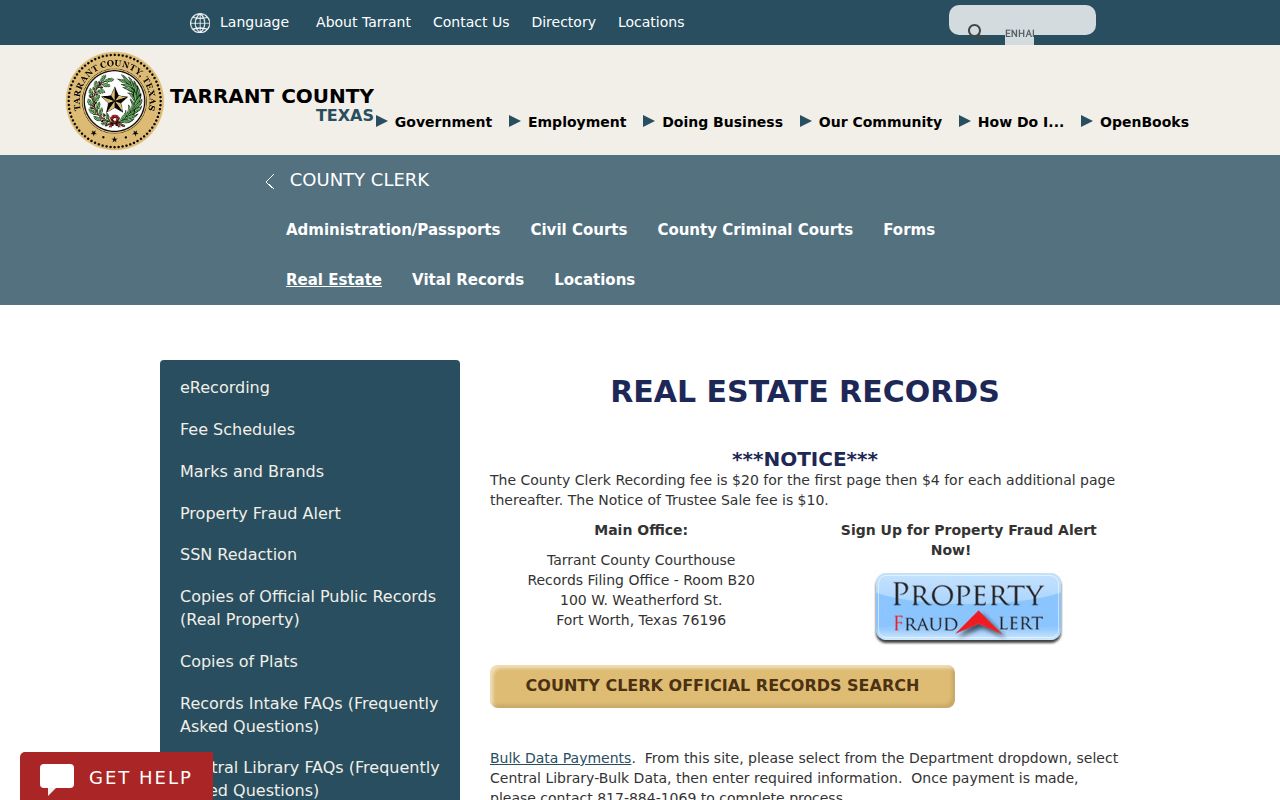
Recording charges are separate from copy charges. The clerk will not conduct a title or lien search, so a request should identify the document, party, date range, or legal-description detail needed.
For city-held material, submit a narrow Texas Public Information Act request by mail, fax, email, or in person. Identify the address, TAD account, subdivision, Block and Lot, document number if known, record type, and date range. The agency must promptly release non-exempt material or provide a written status notice if it cannot do so within ten working days. A written estimate is expected before substantial work when estimated charges exceed $40.
Colleyville Street Privacy Limits
A street directory cannot produce a complete list of renters, household members, utility customers, or driver-record addresses. Texas driver information is restricted under the Driver's Privacy Protection Act, and public property data is not a replacement for it. A mailing address may point to a lender, trust, business, prior owner, or out-of-area correspondence address while the situs remains in Colleyville. A voter lookup is regulated and is not a household roster.
Use at least two independent details before treating same-name records as connected, such as a street, parcel, middle initial, document relationship, or dated organization role. Keep owner, grantor, grantee, registrant, directory subscriber, applicant, and licensee as distinct roles. Protected-address and redaction rules can also make a missing result a privacy limit rather than evidence of absence.
Lawful use. Colleyville address records are for lawful personal research. Do not use them to stalk, harass, intimidate, or harm anyone; Texas Penal Code sections 42.07 and 42.072 address harassment and stalking.